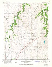
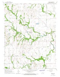
1966 Map of Welda
USGS Topo · Published 1967About this map
The small communities of Welda and Mont Ida anchor this mid-1960s survey of Anderson County, Kansas, where the prairie landscape is defined by the intersection of major rail lines and energy infrastructure. The Atchison Topeka and Santa Fe and Missouri Pacific railroads traverse the terrain, facilitating the transport of local agricultural and industrial goods. Evidence of the region's extraction economy is visible through multiple Gravel Pits, a local Quarry, and an active Oil Field north of Pottawatomie Creek.
Find a feature on this map
26 named features on this map. Tap any name to fly to it.
Don’t see what you’re looking for? This feature index may not catch every label — zoom into the map to look around manually.
Map Details
Editions of this 1966 Welda Map
This is the sole edition of this map. No revisions or reprints were ever made.
Other maps of this area

1885 · Garnett
USGS Topo · 1:125,000

1894 · Garnett
USGS Topo · 1:125,000

1947 · Lawrence
USGS Topo · 1:250,000

1950 · Lawrence
USGS Topo · 1:250,000

1956 · Lawrence
USGS Topo · 1:250,000

1961 · Lawrence
USGS Topo · 1:250,000
1966 · Bush City
USGS Topo · 1:24,000
1966 · Westphalia
USGS Topo · 1:24,000
1966 · Garnett East
USGS Topo · 1:24,000
1966 · Harris
USGS Topo · 1:24,000