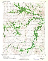
1966 Map of Centerville
USGS Topo · Published 1967About this map
Centerville serves as the primary hub of this eastern Kansas landscape, situated near the headwaters of Sugar Creek and Saline Creek. The mid-1960s terrain reveals a mix of agricultural land and early industrial activity, including an Oil Field and various Oil Wells scattered near the Anderson Co and Linn Co border. Evidence of changing transportation networks is clear, with the Missouri Kansas Texas line traversing the southern portion of the quadrangle while an Old RR Grade runs south from Selma. Genealogists will find interest in localized landmarks such as Oakwood Cem and another Cemetery near the town center. The topography is dominated by the broad elevation of Blue Mound in the southeast, while a Pipeline cuts across the western townships near Vance, reflecting the infrastructure developments of the era.
Find a feature on this map
23 named features on this map. Tap any name to fly to it.
Don’t see what you’re looking for? This feature index may not catch every label — zoom into the map to look around manually.
Map Details
Editions of this 1966 Centerville Map
2 editions found
Other maps of this area

1885 · Garnett
USGS Topo · 1:125,000

1887 · Mound City
USGS Topo · 1:125,000

1893 · Mound City
USGS Topo · 1:125,000

1894 · Garnett
USGS Topo · 1:125,000

1947 · Lawrence
USGS Topo · 1:250,000

1950 · Lawrence
USGS Topo · 1:250,000

1956 · Lawrence
USGS Topo · 1:250,000

1961 · Lawrence
USGS Topo · 1:250,000

1963 · Parker
USGS Topo · 1:24,000
1966 · Mound City NW
USGS Topo · 1:24,000