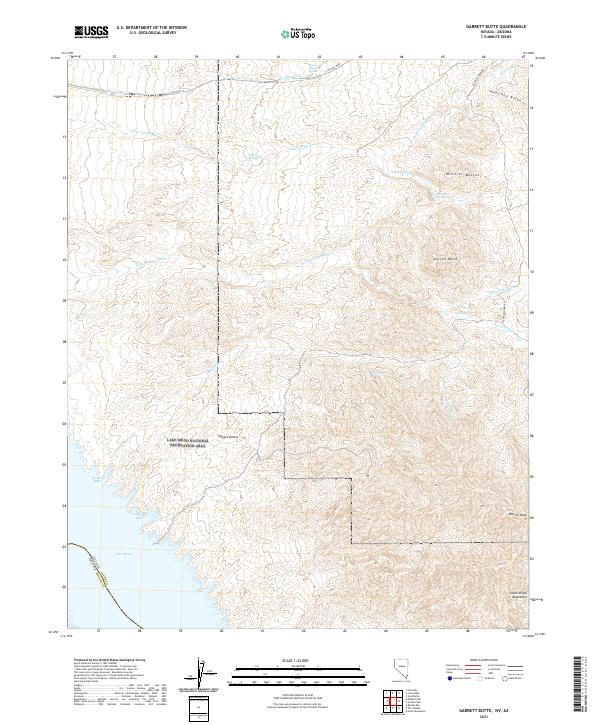
2021 Map of Garrett Butte
USGS Topo · Published 2021About this map
Lake Mead National Recreation Area spans this desert landscape along the border of Nevada and Arizona, where the southern reaches of the Mojave Desert meet the waters of Lake Mead. The topography is defined by significant elevations like Bonelli Peak and the South Virgin Mountains, cut through by a network of seasonal drainages including Twin Springs Wash, Catclaw Wash, and Cataract Wash. Water sources are critical landmarks in this arid environment, with several mapped points of interest such as Fairbanks Spring, Aqua Chiquita Spring, and Gann Spring. Transport across this remote terrain is limited to rugged tracks like Scanlon Ferry Rd, which leads toward the water. Along the shoreline, Lakeside Bays and Walker Bay indicate where the desert terrain meets the reservoir, providing a detailed look at the interface between the high desert peaks and the recreation area's aquatic boundaries.
Find a feature on this map
29 named features on this map. Tap any name to fly to it.
Don’t see what you’re looking for? This feature index may not catch every label — zoom into the map to look around manually.
Map Details
Editions of this 2021 Garrett Butte Map
This is the sole edition of this map. No revisions or reprints were ever made.
Other maps of this area

1886 · Saint Thomas
USGS Topo · 1:250,000

1893 · Saint Thomas
USGS Topo · 1:250,000

1926 · Bonelli
USGS Topo · 1:96,000

1953 · Overton Beach
USGS Topo · 1:62,500

1953 · Iceberg Canyon
USGS Topo · 1:62,500

1953 · Gold Butte
USGS Topo · 1:62,500

1953 · Virgin Basin
USGS Topo · 1:62,500

1954 · Las Vegas
USGS Topo · 1:250,000

1957 · Las Vegas
USGS Topo · 1:250,000

1959 · Las Vegas
USGS Topo · 1:250,000