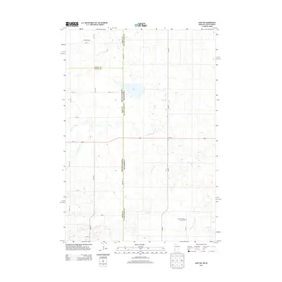
2013 Map of Gary NW
USGS Topo · Published 2013About this map
The South Dakota-Minnesota border bisects this landscape, where the agricultural grid of Deuel County meets Lac qui Parle County. This 2013 survey illustrates a region defined by its water and transport corridors, with Us-212 serving as a primary east-west artery across the prairie. Genealogical interest is anchored by the Mehurin Norwegian Lutheran Cem in the southeastern portion of the map, a site reflecting the heritage of early Scandinavian settlement in the area. North of the highway, the terrain includes Salt Lake and several drainage systems like Lost Cr and the W Br Lac qui Parle River. Small-scale aviation is represented by Lundin Airport in the northwest, while the road network follows a rigid section-line pattern with routes like State Line Rd and Co Hwy-7 framing the rural townships.
Find a feature on this map
25 named features on this map. Tap any name to fly to it.
Don’t see what you’re looking for? This feature index may not catch every label — zoom into the map to look around manually.
Map Details
Editions of this 2013 Gary NW Map
This is the sole edition of this map. No revisions or reprints were ever made.
Other maps of this area

1953 · Bellingham
USGS Topo · 1:62,500

1953 · Milbank
USGS Topo · 1:250,000

1953 · Watertown
USGS Topo · 1:250,000

1958 · Milbank
USGS Topo · 1:250,000

1958 · Watertown
USGS Topo · 1:250,000

1967 · Gary
USGS Topo · 1:24,000

1967 · Gary SE
USGS Topo · 1:24,000

1967 · Gary NW
USGS Topo · 1:24,000
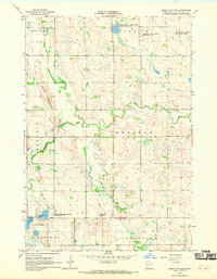
1967 · Mount Wickham
USGS Topo · 1:24,000

1971 · Marietta
USGS Topo · 1:24,000
Featured Places
- Antelope Valley Township, SD
- Glenwood Township, SD
- Lac qui Parle County, MN
- Deuel County, SD
- Grant County, SD