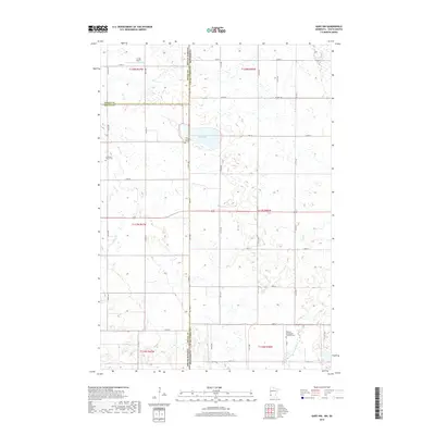
2019 Map of Gary NW
USGS Topo · Published 2019About this map
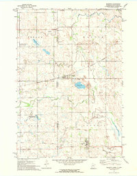
The borderlands where South Dakota and Minnesota meet are defined by the prairie hydrology of the Northern Plains. Along this state line, Salt Lake sits at the center of a complex network of wetlands and intermittent watercourses, including the upper reaches of Lost Cr and the W Br Lac qui Parle River. The landscape is etched with the rectilinear grid of the Public Land Survey System, which dictates the placement of rural infrastructure like Lundin Airport in the northwest corner. This area serves as a significant genealogical anchor, preserving the locations of several pioneer-era burial grounds. The presence of Antelope Valley Cem, Zoar Lutheran Cem, and the Mehurin Norwegian Lutheran Cem speaks to the early Scandinavian and European settlement patterns that established these townships in Grant and Deuel counties.
Find a feature on this map
30 named features on this map. Tap any name to fly to it.
Don’t see what you’re looking for? This feature index may not catch every label — zoom into the map to look around manually.
Map Details
Editions of this 2019 Gary NW Map
This is the sole edition of this map. No revisions or reprints were ever made.
Other maps of this area
1953 · Bellingham
USGS Topo · 1:62,500
1953 · Milbank
USGS Topo · 1:250,000

1953 · Watertown
USGS Topo · 1:250,000
1958 · Milbank
USGS Topo · 1:250,000

1958 · Watertown
USGS Topo · 1:250,000
1967 · Gary
USGS Topo · 1:24,000
1967 · Gary SE
USGS Topo · 1:24,000
1967 · Gary NW
USGS Topo · 1:24,000
1967 · Mount Wickham
USGS Topo · 1:24,000
1971 · Marietta
USGS Topo · 1:24,000
Featured Places
- Antelope Valley Township, SD
- Glenwood Township, SD
- Lac qui Parle County, MN
- Deuel County, SD
- Grant County, SD