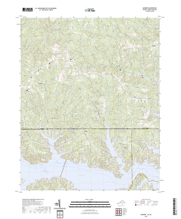
2022 Map of Gasburg
USGS Topo · Published 2022About this map
Lake Gaston dominates the southern landscape of this Virginia-North Carolina borderland, its intricate shoreline creating numerous inlets and points near the settlement of Elams. The terrain is defined by a dense network of tributaries including Rattlesnake Cr and Pea Hill Cr, which flow through the undulating countryside of Brunswick County. This 2022 survey captures the area's rural character, where small communities like Ebony and Ankum are connected by a web of local routes such as Gasburg Rd and Co Rd 903. Genealogists will find several family-named burial sites across the quadrangle, including Powell Cem, Reid Cem, and Clary Cem, illustrating the deep-rooted local history of the region. The map also highlights the prominent Horseshoe Bend along the reservoir's edge, a notable geographic feature for those navigating the waters near the state line.
Find a feature on this map
125 named features on this map. Tap any name to fly to it.
Don’t see what you’re looking for? This feature index may not catch every label — zoom into the map to look around manually.
Map Details
Editions of this 2022 Gasburg Map
This is the sole edition of this map. No revisions or reprints were ever made.
Other maps of this area

1919 · White Plains
USGS Topo · 1:48,000

1920 · White Plains
USGS Topo · 1:62,500

1953 · Norfolk
USGS Topo · 1:250,000

1953 · Greensboro
USGS Topo · 1:250,000

1954 · Greensboro
USGS Topo · 1:250,000

1962 · Greensboro
USGS Topo · 1:250,000

1963 · Powellton
USGS Topo · 1:24,000

1963 · Gasburg
USGS Topo · 1:24,000

1963 · Valentines
USGS Topo · 1:24,000

1963 · White Plains
USGS Topo · 1:24,000