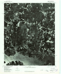
1977 Map of Gasburg
USGS Topo · Published 1979About this map
Lake Gaston dominates the southern portion of this landscape, its fingers reaching northward into a mosaic of woodland and agricultural clearings along the Virginia-North Carolina border. In the late 1970s, the rural character of Brunswick County is captured through detailed aerial imagery, showing the wooded creek valleys and early residential developments along the reservoir's shoreline. The settlements of Gasburg and Ebony serve as the primary local hubs, connected by winding roads that traverse the drainage basins of Lizard Creek and Songbird Creek. This orthophotoquad provides an unfiltered view of the land use patterns surrounding the Roanoke River valley before more modern suburban growth altered the timber and farming parcels of the region.
Find a feature on this map
6 named features on this map. Tap any name to fly to it.
Don’t see what you’re looking for? This feature index may not catch every label — zoom into the map to look around manually.
Map Details
Editions of this 1977 Gasburg Map
This is the sole edition of this map. No revisions or reprints were ever made.
Other maps of this area

1919 · White Plains
USGS Topo · 1:48,000

1920 · White Plains
USGS Topo · 1:62,500

1953 · Norfolk
USGS Topo · 1:250,000

1953 · Greensboro
USGS Topo · 1:250,000

1954 · Greensboro
USGS Topo · 1:250,000

1962 · Greensboro
USGS Topo · 1:250,000

1963 · Powellton
USGS Topo · 1:24,000

1963 · Gasburg
USGS Topo · 1:24,000

1963 · Valentines
USGS Topo · 1:24,000

1963 · White Plains
USGS Topo · 1:24,000