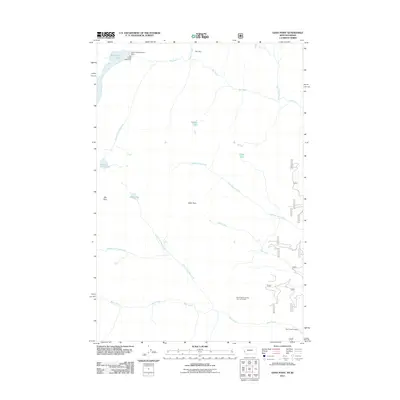
2011 Map of Gash Point
USGS Topo · Published 2011About this map
Starr Mine sits near the northern boundary of this high-elevation terrain, a reminder of the extractive history that once reached into these drainages. The landscape is defined by its water management and natural catchments, including the Big Creek Lakes secured by the Big Creek Lake Dam and the Big Creek Number 2 Dam. These reservoirs anchor a complex network of waterways, with Big Creek and its many tributaries, such as South Fork Big Creek and Saint Mary Creek, carving paths through the area. Recreation and observation points are central to the southern portion of the map, notably at the Bear Creek Overlook Point of Interest and the Bear Creek Trailhead. High peaks and remote lakes like Sky Pilot, Gash Point, and Hidden Lake provide distinct geographic markers for researchers tracing the hydrology of Ravalli County.
Find a feature on this map
21 named features on this map. Tap any name to fly to it.
Don’t see what you’re looking for? This feature index may not catch every label — zoom into the map to look around manually.
Map Details
Editions of this 2011 Gash Point Map
This is the sole edition of this map. No revisions or reprints were ever made.
Other maps of this area

1901 · Hamilton
USGS Topo · 1:125,000

1912 · Missoula
USGS Topo · 1:125,000

1956 · Hamilton
USGS Topo · 1:250,000

1959 · Hamilton
USGS Topo · 1:250,000

1960 · Hamilton
USGS Topo · 1:250,000

1964 · Hamilton
USGS Topo · 1:250,000

1964 · St. Joseph Peak
USGS Topo · 1:24,000
1964 · Ranger Peak
USGS Topo · 1:24,000
1966 · Blodgett Mtn
USGS Topo · 1:24,000
1966 · White Sand Lake
USGS Topo · 1:24,000