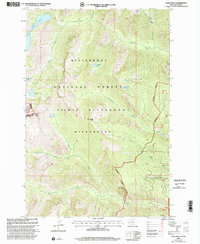
1998 Map of Gash Point
USGS Topo · Published 2002About this map
Bitterroot National Forest and the Selway-Bitterroot Wilderness define this high-altitude landscape along the Bitterroot Divide. The map documents the complex drainage systems that flow east into the Bitterroot Valley, including Sweathouse Creek and Gash Creek. Notable high-country landmarks include Sky Pilot and Gash Point, which serve as orientation points for the numerous glacial lakes scattered across the granite basins, such as Big Creek Lakes, Pearl Lake, and Hidden Lake.
Find a feature on this map
24 named features on this map. Tap any name to fly to it.
Don’t see what you’re looking for? This feature index may not catch every label — zoom into the map to look around manually.
Map Details
Editions of this 1998 Gash Point Map
This is the sole edition of this map. No revisions or reprints were ever made.
Other maps of this area

1901 · Hamilton
USGS Topo · 1:125,000

1912 · Missoula
USGS Topo · 1:125,000

1956 · Hamilton
USGS Topo · 1:250,000

1959 · Hamilton
USGS Topo · 1:250,000

1960 · Hamilton
USGS Topo · 1:250,000

1964 · Hamilton
USGS Topo · 1:250,000

1964 · St. Joseph Peak
USGS Topo · 1:24,000
1964 · Ranger Peak
USGS Topo · 1:24,000
1966 · Blodgett Mtn
USGS Topo · 1:24,000
1966 · White Sand Lake
USGS Topo · 1:24,000