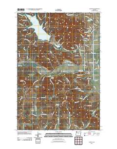
2011 Map of Gaston
USGS Topo · Published 2011About this map
The Tualatin River and its tributaries define this agricultural and timber landscape west of the Portland metropolitan area. The town of Gaston serves as a central hub, flanked by the Wapato Lake Bed to the east and the timber operations at Stimson Mill to the west. Industrial and logistical footprints are visible through the Stimson Millpond and the Goodin Creek Airport, while the area's rural character is maintained by smaller settlements like Cherry Grove, Seghers, and Cove Orchard.
Find a feature on this map
101 named features on this map. Tap any name to fly to it.
Don’t see what you’re looking for? This feature index may not catch every label — zoom into the map to look around manually.
Map Details
Editions of this 2011 Gaston Map
This is the sole edition of this map. No revisions or reprints were ever made.
Other maps of this area

1941 · Timber
USGS Topo · 1:62,500

1941 · Gales Creek
USGS Topo · 1:62,500

1941 · Yamhill
USGS Topo · 1:62,500

1942 · Yamhill
USGS Topo · 1:62,500

1942 · Fairdale
USGS Topo · 1:62,500

1948 · Vancouver
USGS Topo · 1:250,000

1950 · Vancouver
USGS Topo · 1:250,000

1950 · Vancouver
USGS Topo · 1:250,000

1955 · Timber
USGS Topo · 1:62,500

1955 · Fairdale
USGS Topo · 1:62,500