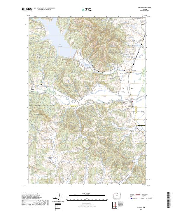
2024 Map of Gaston
USGS Topo · Published 2024About this map
The Tualatin River snakes through the central landscape of this western Oregon survey, defining the fertile reaches of Patton Valley. The region is anchored by the community of Gaston and the specialized Wapato Lake National Wildlife Refuge to the southeast, where the distinct Wapato Lake Bed dominates the lowlands near Cove Orchard. The map illustrates the region's historical reliance on timber and water management, visible in the presence of the Stimson Millpond and the sprawling expanse of Henry Hagg Lake.
Find a feature on this map
96 named features on this map. Tap any name to fly to it.
Don’t see what you’re looking for? This feature index may not catch every label — zoom into the map to look around manually.
Map Details
Editions of this 2024 Gaston Map
This is the sole edition of this map. No revisions or reprints were ever made.
Other maps of this area

1941 · Timber
USGS Topo · 1:62,500

1941 · Gales Creek
USGS Topo · 1:62,500

1941 · Yamhill
USGS Topo · 1:62,500

1942 · Yamhill
USGS Topo · 1:62,500

1942 · Fairdale
USGS Topo · 1:62,500

1948 · Vancouver
USGS Topo · 1:250,000

1950 · Vancouver
USGS Topo · 1:250,000

1950 · Vancouver
USGS Topo · 1:250,000

1955 · Timber
USGS Topo · 1:62,500

1955 · Fairdale
USGS Topo · 1:62,500