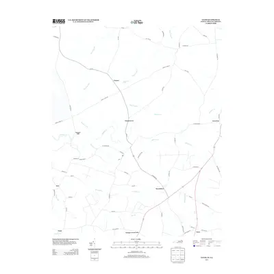
2013 Map of Gates
USGS Topo · Published 2013About this map
Reynoldson and Pittmantown anchor this rural landscape along the North Carolina and Virginia border, a region defined by its intricate network of slow-moving water and low-lying drainages. The geography is dominated by extensive wetlands such as Chapel Swamp, March Swamp, and Mill Swamp, which dictate the placement of local roads and long-established crossroads. Small settlements and family-named locales like Cleopus, Savages Crossroads, and Factory Hill are connected by a web of paths including Corinth Chapel Rd and Pittmantown Rd. This area reflects the traditional coastal plain settlement patterns, where small communities evolved around specific intersections and high ground near water features like Holy Neck Pond and the headwaters of Somerton Creek. The map provides a look at the rural character of Gates County in the early twenty-first century, showing how modern transit corridors like US Route 13 overlay the older, winding routes of the region.
Find a feature on this map
60 named features on this map. Tap any name to fly to it.
Don’t see what you’re looking for? This feature index may not catch every label — zoom into the map to look around manually.
Map Details
Editions of this 2013 Gates Map
This is the sole edition of this map. No revisions or reprints were ever made.
Other maps of this area

1906 · Beckford
USGS Topo · 1:48,000

1907 · Beckford
USGS Topo · 1:62,500

1908 · Winton
USGS Topo · 1:62,500

1919 · Suffolk
USGS Topo · 1:62,500

1920 · Holland
USGS Topo · 1:62,500

1940 · Beckford
USGS Topo · 1:62,500

1943 · Holland
USGS Topo · 1:62,500

1953 · Norfolk
USGS Topo · 1:250,000
1954 · Buckhorn
USGS Topo · 1:24,000
1954 · Suffolk
USGS Topo · 1:62,500