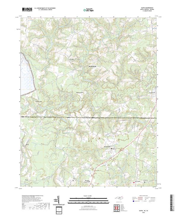
2022 Map of Gates
USGS Topo · Published 2022About this map
The Virginia-North Carolina border cuts directly through this landscape, dividing the community of Somerton from southern hamlets like Reynoldson. The terrain is defined by an intricate network of wetlands, including Chapel Swamp and March Swamp, which historically dictated the placement of roads and small agricultural settlements. Genealogists will find significant value in the mapped churchyards and private burial grounds, such as the Gatling Family Cem near Savages Crossroads and the Reynoldson Baptist Church Cem. The map illustrates a rural settlement pattern where crossroads like Pittmantown and Factory Hill served as local hubs. Waterways like Somerton Creek and Mill Swamp drain the region, creating the wooded bottomlands that have long characterized this borderland area between Suffolk and Gates County.
Find a feature on this map
73 named features on this map. Tap any name to fly to it.
Don’t see what you’re looking for? This feature index may not catch every label — zoom into the map to look around manually.
Map Details
Editions of this 2022 Gates Map
This is the sole edition of this map. No revisions or reprints were ever made.
Other maps of this area

1906 · Beckford
USGS Topo · 1:48,000

1907 · Beckford
USGS Topo · 1:62,500

1908 · Winton
USGS Topo · 1:62,500

1919 · Suffolk
USGS Topo · 1:62,500

1920 · Holland
USGS Topo · 1:62,500

1940 · Beckford
USGS Topo · 1:62,500

1943 · Holland
USGS Topo · 1:62,500

1953 · Norfolk
USGS Topo · 1:250,000
1954 · Buckhorn
USGS Topo · 1:24,000
1954 · Suffolk
USGS Topo · 1:62,500