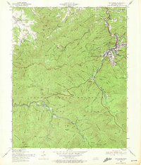
1956 Map of Gatlinburg
USGS Topo · Published 1972About this map
Gatlinburg serves as the gateway to the Great Smoky Mountains National Park on this mid-century survey, illustrating the town's early development as a major park entrance. Along the West Prong of the Little Pigeon River, the Pi Beta Phi Settlement School and various civic landmarks like the Stadium and Cable Lift appear just as the area's tourism infrastructure began to expand. Southward, the map details the rugged interior of the national park, including the historic settlement site at Elkmont and the Sugarlands Ranger Station.
Find a feature on this map
139 named features on this map. Tap any name to fly to it.
Don’t see what you’re looking for? This feature index may not catch every label — zoom into the map to look around manually.
Map Details
Editions of this 1956 Gatlinburg Map
2 editions found
Other maps of this area

1886 · Knoxville
USGS Topo · 1:125,000

1892 · Knoxville
USGS Topo · 1:125,000

1893 · Mt Guyot
USGS Topo · 1:125,000

1894 · Knoxville
USGS Topo · 1:125,000

1895 · Knoxville
USGS Topo · 1:125,000

1901 · Knoxville
USGS Topo · 1:125,000

1912 · Mt Guyot
USGS Topo · 1:125,000

1935 · English Mountain
USGS Topo · 1:48,000

1935 · Walden Creek
USGS Topo · 1:24,000

1935 · Richardson Cove
USGS Topo · 1:24,000