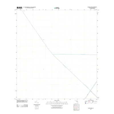
2012 Map of Gator Lake
USGS Topo · Published 2012About this map
Gator Lake sits at the northern edge of this section of the Florida Everglades, a landscape dominated by the massive water management infrastructure of the early 21st century. The map highlights the engineered character of the region, where the diagonal path of the Miami Canal and the intersecting S New River Canal coordinate the flow of water across Broward County. These primary arteries are supported by secondary levees and roads such as L-67-A and L-67-C, which form a geometric grid over the wetlands. Unlike more developed areas of the state, this survey reveals an environment defined almost entirely by hydrological control and drainage projects, providing a clear record of the system of canals and embankments that underpin the modern South Florida landscape.
Find a feature on this map
5 named features on this map. Tap any name to fly to it.
Don’t see what you’re looking for? This feature index may not catch every label — zoom into the map to look around manually.
Map Details
Editions of this 2012 Gator Lake Map
This is the sole edition of this map. No revisions or reprints were ever made.
Other maps of this area

1956 · Miami
USGS Topo · 1:250,000

1956 · West Palm Beach
USGS Topo · 1:250,000

1957 · West Palm Beach
USGS Topo · 1:250,000

1958 · West Palm Beach
USGS Topo · 1:250,000

1958 · Miami
USGS Topo · 1:250,000

1963 · Andytown
USGS Topo · 1:24,000

1963 · Pennsuco
USGS Topo · 1:24,000

1963 · Cooper City SW
USGS Topo · 1:24,000

1973 · Custard Apple Hammock
USGS Topo · 1:24,000

1973 · West Of Pennsuco
USGS Topo · 1:24,000