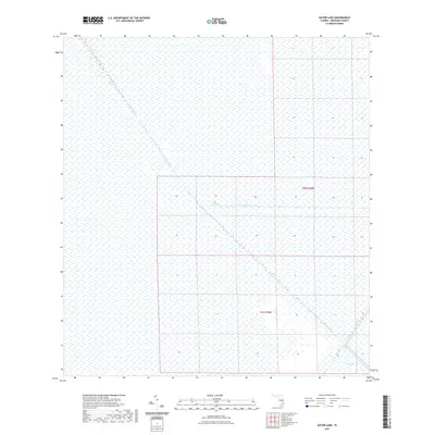
2021 Map of Gator Lake
USGS Topo · Published 2021About this map
The Everglades dominate this 2021 topographic sheet, revealing the engineered hydrology of Broward County. The landscape is defined by the massive diagonal of the Miami Canal, a primary artery for water management in the region. This canal is intersected by the South New River Canal, illustrating the rigid grid of the Central and Southern Florida Flood Control Project. In the lower right corner, the terrain transitions into a specific landform labeled The Pocket. This map provides a clear view of the modern boundaries and township divisions, including t50s r38e and t51s r38e, which segment this otherwise continuous wetland environment.
Find a feature on this map
6 named features on this map. Tap any name to fly to it.
Don’t see what you’re looking for? This feature index may not catch every label — zoom into the map to look around manually.
Map Details
Editions of this 2021 Gator Lake Map
This is the sole edition of this map. No revisions or reprints were ever made.
Other maps of this area

1956 · Miami
USGS Topo · 1:250,000

1956 · West Palm Beach
USGS Topo · 1:250,000

1957 · West Palm Beach
USGS Topo · 1:250,000

1958 · West Palm Beach
USGS Topo · 1:250,000

1958 · Miami
USGS Topo · 1:250,000

1963 · Andytown
USGS Topo · 1:24,000

1963 · Pennsuco
USGS Topo · 1:24,000

1963 · Cooper City SW
USGS Topo · 1:24,000

1973 · Custard Apple Hammock
USGS Topo · 1:24,000

1973 · West Of Pennsuco
USGS Topo · 1:24,000