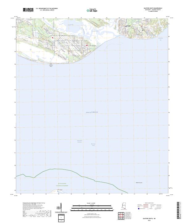
2024 Map of Gautier South
USGS Topo · Published 2024About this map
Graveline Bay and the winding Graveline Bayou dominate the coastal topography of this Jackson County shoreline, where residential development in Gautier meets the tidal marshlands. The map reveals a transition from established neighborhoods near Bethel Cem to the protected wilderness of the Gulf Islands National Seashore along the southern horizon. This coastal survey documents the intricate intersection of land and sea at Belle Fontaine Point, framing the northern reaches of the Mississippi Sound and its connection to the Intracoastal Waterway. To the south, the northern edge of Horn Island stands as a barrier against the Gulf of Mexico, while the Middle Ground shoal marks the navigation challenges within the sound. Local road networks like Biddix-Evans Rd and Belle Fontaine Rd provide the backbone for the community's contemporary layout.
Find a feature on this map
76 named features on this map. Tap any name to fly to it.
Don’t see what you’re looking for? This feature index may not catch every label — zoom into the map to look around manually.
Map Details
Editions of this 2024 Gautier South Map
This is the sole edition of this map. No revisions or reprints were ever made.
Other maps of this area

1941 · Horn Island
USGS Topo · 1:62,500

1942 · Horn Island
USGS Topo · 1:62,500

1943 · Pascagoula
USGS Topo · 1:62,500

1950 · Dog Keys Pass
USGS Topo · 1:24,000

1953 · Mobile
USGS Topo · 1:250,000

1954 · Ocean Springs
USGS Topo · 1:24,000

1954 · Deer Island
USGS Topo · 1:24,000

1954 · Biloxi
USGS Topo · 1:62,500

1955 · Pascagoula
USGS Topo · 1:62,500

1957 · Mobile
USGS Topo · 1:250,000