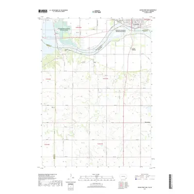
2017 Map of Gavins Point Dam
USGS Topo · Published 2017About this map
Yankton dominates the northern bank of the Missouri River in this detailed 2017 study of the South Dakota and Nebraska border. The landscape is defined by the massive infrastructure of the Gavins Point Dam, which impounds Lewis and Clark Lake and created the smaller Lake Yankton immediately downstream. This area serves as a critical junction for regional history and modern conservation, featuring the Gavins Point National Fish Hatchery and the protected corridor of the Missouri National Recreation River.
Find a feature on this map
53 named features on this map. Tap any name to fly to it.
Don’t see what you’re looking for? This feature index may not catch every label — zoom into the map to look around manually.
Map Details
Editions of this 2017 Gavins Point Dam Map
This is the sole edition of this map. No revisions or reprints were ever made.
Other maps of this area

1955 · Sioux City
USGS Topo · 1:250,000

1957 · Mission Hill
USGS Topo · 1:24,000

1958 · Sioux City
USGS Topo · 1:250,000

1959 · Sioux City
USGS Topo · 1:250,000

1968 · Tabor SE
USGS Topo · 1:24,000

1968 · Bloomfield NE
USGS Topo · 1:24,000

1968 · Gavins Point Dam
USGS Topo · 1:24,000

1968 · Crofton
USGS Topo · 1:24,000

1968 · Fordyce
USGS Topo · 1:24,000
1968 · Menominee
USGS Topo · 1:24,000