
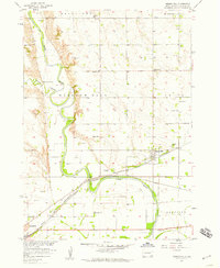
1957 Map of Mission Hill
USGS Topo · Published 1958About this map
The James River meanders through Yankton County, defining a landscape of low-lying river bottoms and the prominent rise of Mission Hill. In the late 1950s, this area was characterized by a dense network of rural school districts, including Welby Sch, Willowdale Sch, and Bruget Sch, reflecting a highly localized agricultural society. The settlement of Mission Hill serves as a central hub, situated where the Chicago and North Western and Chicago Milwaukee St Paul and Pacific railroads converge.
Find a feature on this map
26 named features on this map. Tap any name to fly to it.
Don’t see what you’re looking for? This feature index may not catch every label — zoom into the map to look around manually.
Map Details
Editions of this 1957 Mission Hill Map
2 editions found
Other maps of this area

1898 · Parker
USGS Topo · 1:125,000

1955 · Sioux City
USGS Topo · 1:250,000

1955 · Sioux Falls
USGS Topo · 1:250,000

1957 · Gayville
USGS Topo · 1:24,000

1957 · Mayfield
USGS Topo · 1:24,000

1957 · Jamesville
USGS Topo · 1:24,000

1958 · Sioux City
USGS Topo · 1:250,000

1958 · Sioux Falls
USGS Topo · 1:250,000

1959 · Sioux City
USGS Topo · 1:250,000

1968 · St. Helena
USGS Topo · 1:24,000