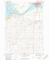
1968 Map of Gavins Point Dam
USGS Topo · Published 1982About this map
The Gavins Point Dam stands as the central engineering marvel on this map, controlling the flow of the Missouri River and creating the expansive Lewis and Clark Lake. This area at the border of Nebraska and South Dakota serves as a major hub for both industry and recreation, featuring the Gavins Point National Fish Hatchery and numerous parks like the Chief White Crane Recreation Area. The landscape transitions from the river valley's technical infrastructure to the rural tablelands of Cedar Co and Knox Co.
Find a feature on this map
45 named features on this map. Tap any name to fly to it.
Don’t see what you’re looking for? This feature index may not catch every label — zoom into the map to look around manually.
Map Details
Editions of this 1968 Gavins Point Dam Map
2 editions found
Other maps of this area

1955 · Sioux City
USGS Topo · 1:250,000

1957 · Mission Hill
USGS Topo · 1:24,000

1958 · Sioux City
USGS Topo · 1:250,000

1959 · Sioux City
USGS Topo · 1:250,000

1968 · Tabor SE
USGS Topo · 1:24,000

1968 · Bloomfield NE
USGS Topo · 1:24,000

1968 · Gavins Point Dam
USGS Topo · 1:24,000

1968 · Crofton
USGS Topo · 1:24,000

1968 · Fordyce
USGS Topo · 1:24,000
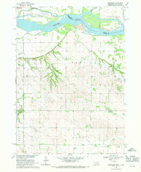
1968 · Menominee
USGS Topo · 1:24,000