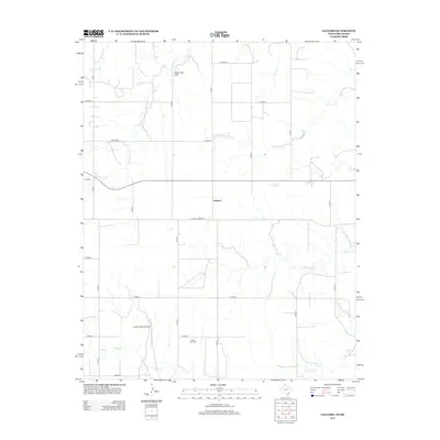
2012 Map of Gaylord
USGS Topo · Published 2012About this map
The High Plains of the Texas Panhandle define this landscape, where the settlement of Gaylord serves as a central point in a vast grid of county roads. The terrain is marked by the branching drainage systems of Kiowa Cr and its tributaries, including N Fork Kiowa Cr, Plummer Cr, and Coyote Cr. These waterways cut through the flat agricultural expanse, creating distinctive landmarks such as Bean Pott Cliff in the northern portion of the quadrangle. Local history is anchored by the View Point Cem and the Loesch Ranch Airport, reflecting the region's ranching and rural aviation heritage. Transportation in the area follows a strict section-line pattern, though the path of Old Darrouzett road suggests an older route through the plains. The presence of Timmcity and various local routes like Co Road B and Co Road J provide a detailed look at the infrastructure supporting this remote part of Lipscomb County.
Find a feature on this map
25 named features on this map. Tap any name to fly to it.
Don’t see what you’re looking for? This feature index may not catch every label — zoom into the map to look around manually.
Map Details
Editions of this 2012 Gaylord Map
This is the sole edition of this map. No revisions or reprints were ever made.
Other maps of this area

1954 · Perryton
USGS Topo · 1:250,000

1958 · Perryton
USGS Topo · 1:250,000

1971 · Clear Lake SW
USGS Topo · 1:24,000

1971 · Clear Lake SE
USGS Topo · 1:24,000

1972 · Dugout Creek
USGS Topo · 1:24,000

1972 · Darrouzett
USGS Topo · 1:24,000

1972 · Gaylord
USGS Topo · 1:24,000

1972 · Twin Grove
USGS Topo · 1:24,000

1972 · Booker SE
USGS Topo · 1:24,000

1973 · Booker
USGS Topo · 1:24,000