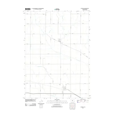
2012 Map of Gayville
USGS Topo · Published 2012About this map
Gayville and the southern edge of Volin anchor this landscape in Yankton County, where the transition from higher ground toward the Missouri River valley is marked by an extensive network of drainage and water management. The flat terrain is defined by a rigid grid of rural avenues and streets, but the natural paths of Clay Cr, Turkey Cr, and Smoky Run break this regularity as they meander toward the bottomlands. Significant engineering is evident in the presence of the Clay Creek Ditch and the Yankton Clay Ditch, which work to manage the hydrology of this agricultural region. Local history is centered around the Gayville Cem and Volin Cem, which serve as quiet landmarks for these long-established farming communities. The path of Bluff Rd follows the subtle elevation changes that define the northern edge of the flood plain.
Find a feature on this map
32 named features on this map. Tap any name to fly to it.
Don’t see what you’re looking for? This feature index may not catch every label — zoom into the map to look around manually.
Map Details
Editions of this 2012 Gayville Map
This is the sole edition of this map. No revisions or reprints were ever made.
Other maps of this area

1898 · Parker
USGS Topo · 1:125,000

1955 · Sioux City
USGS Topo · 1:250,000

1955 · Sioux Falls
USGS Topo · 1:250,000

1957 · Gayville
USGS Topo · 1:24,000

1957 · Mayfield
USGS Topo · 1:24,000

1957 · Mission Hill
USGS Topo · 1:24,000

1958 · Sioux City
USGS Topo · 1:250,000

1958 · Sioux Falls
USGS Topo · 1:250,000

1959 · Sioux City
USGS Topo · 1:250,000

1968 · St. Helena
USGS Topo · 1:24,000