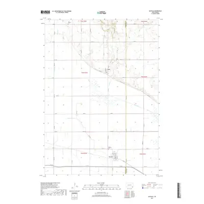
2017 Map of Gayville
USGS Topo · Published 2017About this map
Gayville and Volin anchor this portrait of the southeastern South Dakota landscape along the Yankton Co / Clay Co border. The terrain is defined by an extensive network of water management features, including the Yankton Clay Ditch and Clay Cr Ditch, which redirect natural flows from Clay Cr and Smoky Run across the level plains. This irrigation and drainage system highlights the region's agricultural foundations, where a rigid grid of section-line roads like 450th Ave and 308th St organizes the fertile territory.
Find a feature on this map
45 named features on this map. Tap any name to fly to it.
Don’t see what you’re looking for? This feature index may not catch every label — zoom into the map to look around manually.
Map Details
Editions of this 2017 Gayville Map
This is the sole edition of this map. No revisions or reprints were ever made.
Other maps of this area

1898 · Parker
USGS Topo · 1:125,000

1955 · Sioux City
USGS Topo · 1:250,000

1955 · Sioux Falls
USGS Topo · 1:250,000

1957 · Gayville
USGS Topo · 1:24,000

1957 · Mayfield
USGS Topo · 1:24,000

1957 · Mission Hill
USGS Topo · 1:24,000

1958 · Sioux City
USGS Topo · 1:250,000

1958 · Sioux Falls
USGS Topo · 1:250,000

1959 · Sioux City
USGS Topo · 1:250,000

1968 · St. Helena
USGS Topo · 1:24,000