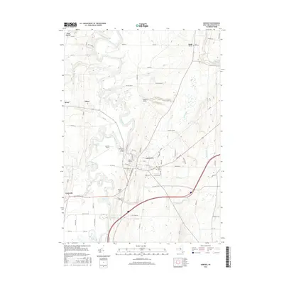
2016 Map of Geneseo
USGS Topo · Published 2016About this map
The Geneseo village core, centered on the SUNY at Geneseo campus, dominates this 2016 survey of the Genesee Valley. The landscape transitions from the developed academic and residential streets of the village to the fertile agricultural flats of the Genesee River. To the west, the mining and railroad-influenced settlements of Retsof and Piffard sit near the river bends, while Cuylerville occupies the southwestern corner. The mapping detail shows a mix of educational infrastructure and rural landmarks, such as the Geneseo Airport and the Geneseo River Bridge. Significant natural features include the dramatic Triphammer Falls and Fall Brook Falls, which illustrate the steep relief and drainage patterns feeding into the main river channel. Local history and genealogy are supported by the clear marking of several burial grounds, including Temple Hill Cem, Saint Marys Cem, and South Avon Cem.
Find a feature on this map
63 named features on this map. Tap any name to fly to it.
Don’t see what you’re looking for? This feature index may not catch every label — zoom into the map to look around manually.
Map Details
Editions of this 2016 Geneseo Map
This is the sole edition of this map. No revisions or reprints were ever made.
Other maps of this area

1901 · Honeoye
USGS Topo · 1:62,500

1902 · Wayland
USGS Topo · 1:62,500

1904 · Wayland
USGS Topo · 1:62,500

1904 · Caledonia
USGS Topo · 1:62,500

1904 · Honeoye
USGS Topo · 1:62,500

1905 · Nunda
USGS Topo · 1:62,500

1934 · Rush
USGS Topo · 1:24,000

1942 · Conesus
USGS Topo · 1:31,680
1942 · Livonia
USGS Topo · 1:31,680

1943 · Mount Morris
USGS Topo · 1:24,000