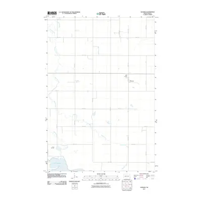
2011 Map of Geneseo
USGS Topo · Published 2011About this map
Geneseo sits as a quiet focal point in this portion of Sargent County, marked by its grid of local streets and the nearby Saint Martin Cemetery. The surrounding landscape is defined by the wandering path of the Wild Rice River and its tributary, Shortfoot Creek, which meanders across the prairie towards the southern wetlands. The section-line road network, including routes like County Hwy 14 and 90th St SE, illustrates the persistent township-and-range layout of North Dakota's agricultural heartland. To the southwest, the waters of Lake Tewaukon are managed by the North Bay Dam, a critical hydraulic feature in this drainage basin. This survey provides a clear view of the rural infrastructure and hydrological patterns established by the early 21st century.
Find a feature on this map
24 named features on this map. Tap any name to fly to it.
Don’t see what you’re looking for? This feature index may not catch every label — zoom into the map to look around manually.
Map Details
Editions of this 2011 Geneseo Map
This is the sole edition of this map. No revisions or reprints were ever made.
Other maps of this area

1907 · Wyndmere
USGS Topo · 1:125,000

1953 · Milbank
USGS Topo · 1:250,000

1953 · Fargo
USGS Topo · 1:250,000

1956 · Fargo
USGS Topo · 1:250,000

1958 · Milbank
USGS Topo · 1:250,000

1958 · Marlow
USGS Topo · 1:24,000

1958 · Veblen NE
USGS Topo · 1:24,000

1958 · Cayuga NW
USGS Topo · 1:24,000

1958 · Hamlin
USGS Topo · 1:24,000

1958 · Geneseo
USGS Topo · 1:24,000