
1958 Map of Cayuga NW
USGS Topo · Published 1960About this map
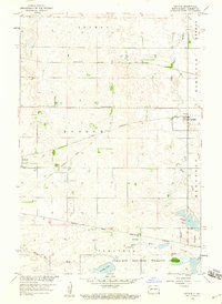
Storm Lake Nat Wildlife Refuge anchors the northern reaches of this Sargent County landscape, where the prairie is defined by a dense collection of glacial lakes and depressions. The presence of Fangsrud Lake Bed alongside permanent waters like Kandiotta Lake and Borg Lake illustrates the fluctuating hydrology of the region in the late 1950s. Local civic and social life in the rural townships of Milnor, Shuman, and Herman is marked by scattered cornerstones including Concordia Ch, School No 3, and a centrally located Town Hall. For genealogists, the map preserves the exact locations of local resting places such as Union Cem and Shuman Cem, providing a precise spatial record of these rural communities before further agricultural consolidation.
Find a feature on this map
18 named features on this map. Tap any name to fly to it.
Don’t see what you’re looking for? This feature index may not catch every label — zoom into the map to look around manually.
Map Details
Editions of this 1958 Cayuga NW Map
This is the sole edition of this map. No revisions or reprints were ever made.
Other maps of this area

1907 · Wyndmere
USGS Topo · 1:125,000

1953 · Fargo
USGS Topo · 1:250,000

1956 · Fargo
USGS Topo · 1:250,000

1958 · Rutland
USGS Topo · 1:24,000

1958 · Hamlin
USGS Topo · 1:24,000

1958 · Geneseo
USGS Topo · 1:24,000
1958 · Cayuga
USGS Topo · 1:24,000

1960 · Lisbon SE
USGS Topo · 1:24,000

1960 · De Lamere
USGS Topo · 1:24,000

1960 · Milnor
USGS Topo · 1:24,000