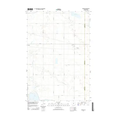
2014 Map of Geneseo
USGS Topo · Published 2014About this map
Geneseo and Cayuga anchor this rural section of the prairie, where the local economy and social life follow a strict grid of section roads. The landscape is defined by the winding course of the Wild Rice River and the glacial depressions that form Lake Tewaukon, Murach Lake, and Grass Lake. These water bodies and the drainage of Shortfoot Cr provide a natural counterpoint to the engineered precision of the township range lines.
Find a feature on this map
27 named features on this map. Tap any name to fly to it.
Don’t see what you’re looking for? This feature index may not catch every label — zoom into the map to look around manually.
Map Details
Editions of this 2014 Geneseo Map
This is the sole edition of this map. No revisions or reprints were ever made.
Other maps of this area

1907 · Wyndmere
USGS Topo · 1:125,000

1953 · Milbank
USGS Topo · 1:250,000

1953 · Fargo
USGS Topo · 1:250,000

1956 · Fargo
USGS Topo · 1:250,000

1958 · Milbank
USGS Topo · 1:250,000

1958 · Marlow
USGS Topo · 1:24,000

1958 · Veblen NE
USGS Topo · 1:24,000

1958 · Cayuga NW
USGS Topo · 1:24,000

1958 · Hamlin
USGS Topo · 1:24,000

1958 · Geneseo
USGS Topo · 1:24,000