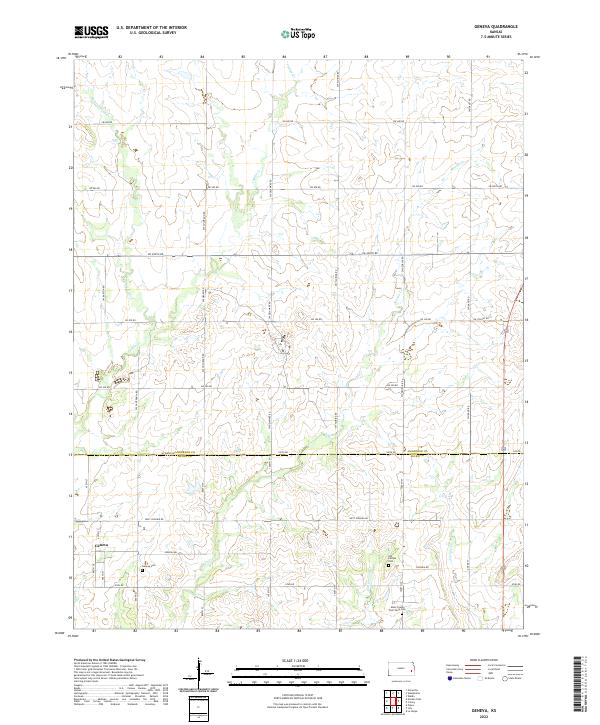
2022 Map of Geneva
USGS Topo · Published 2022About this map
Geneva sits at the southwestern edge of this landscape, a small rural center defined by its agricultural grid and quiet watercourses. The terrain is shaped by the drainage patterns of several creeks, including Little Indian Cr, Indian Cr, and Martin Cr, which carve subtle valleys through the farmland of Anderson and Allen Counties. A notable concentration of history is found along the southern boundary, where the Geneva Cem, Old Carlyle Cem, and the Allen County Poor Farm Cem are situated.
Find a feature on this map
44 named features on this map. Tap any name to fly to it.
Don’t see what you’re looking for? This feature index may not catch every label — zoom into the map to look around manually.
Map Details
Editions of this 2022 Geneva Map
This is the sole edition of this map. No revisions or reprints were ever made.
Other maps of this area

1885 · Burlington
USGS Topo · 1:125,000

1885 · Garnett
USGS Topo · 1:125,000

1886 · Fredonia
USGS Topo · 1:125,000

1886 · Iola
USGS Topo · 1:125,000

1893 · Iola
USGS Topo · 1:125,000

1894 · Garnett
USGS Topo · 1:125,000

1894 · Fredonia
USGS Topo · 1:125,000

1894 · Burlington
USGS Topo · 1:125,000

1904 · Iola
USGS Topo · 1:125,000

1947 · Lawrence
USGS Topo · 1:250,000