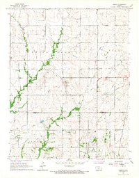
1966 Map of Geneva
USGS Topo · Published 1967About this map
Indian Creek and Martin Creek wind through the rolling prairie of the Ozark region, defining a landscape marked by mid-century rural industry and infrastructure. The small settlement of Geneva serves as a local focal point near the Geneva Cem, while the southern portion of the map transitions into the Carlyle area. Evidence of the region's economic foundations is visible in the scattered Gas Wells, a designated Oil Field, and several Gravel Pits found along the creek banks.
Find a feature on this map
28 named features on this map. Tap any name to fly to it.
Don’t see what you’re looking for? This feature index may not catch every label — zoom into the map to look around manually.
Map Details
Editions of this 1966 Geneva Map
This is the sole edition of this map. No revisions or reprints were ever made.
Other maps of this area

1885 · Burlington
USGS Topo · 1:125,000

1885 · Garnett
USGS Topo · 1:125,000

1886 · Fredonia
USGS Topo · 1:125,000

1886 · Iola
USGS Topo · 1:125,000

1893 · Iola
USGS Topo · 1:125,000

1894 · Garnett
USGS Topo · 1:125,000

1894 · Fredonia
USGS Topo · 1:125,000

1894 · Burlington
USGS Topo · 1:125,000

1904 · Iola
USGS Topo · 1:125,000

1947 · Lawrence
USGS Topo · 1:250,000