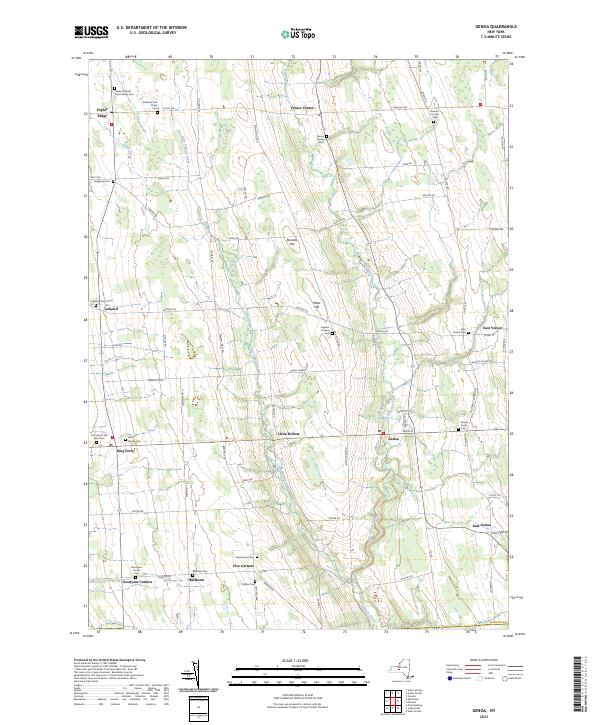
2023 Map of Genoa
USGS Topo · Published 2023About this map
The rolling agricultural landscape of southern Cayuga County is defined by the deep north-south ravines of Big Salmon Creek and Little Salmon Creek. These waterways dictate the local geography, with historic settlements like Genoa and Venice Center established on the high ground between them. The map reveals a dense network of early rural sites, including the Quaker Friends Poplar Ridge Cem and the Ledyard Church Cem, which reflect the area's 19th-century religious and social foundations. Small crossroads hamlets such as Five Corners and Goodyear Corners remain distinct, connected by a grid of named rural roads like Ledyard Rd and Indian Field Rd. The density of small family and community burial grounds, from the Rathbun And Chase Cem to the Stewarts Corners Cem, provides significant data for genealogists tracing the early farming families of the Finger Lakes region.
Find a feature on this map
82 named features on this map. Tap any name to fly to it.
Don’t see what you’re looking for? This feature index may not catch every label — zoom into the map to look around manually.
Map Details
Editions of this 2023 Genoa Map
This is the sole edition of this map. No revisions or reprints were ever made.
Other maps of this area

1898 · Moravia
USGS Topo · 1:62,500

1899 · Auburn
USGS Topo · 1:62,500

1899 · Skaneateles
USGS Topo · 1:62,500

1902 · Skaneateles
USGS Topo · 1:62,500

1902 · Moravia
USGS Topo · 1:62,500

1902 · Genoa
USGS Topo · 1:62,500

1902 · Auburn
USGS Topo · 1:62,500

1942 · Ludlowville
USGS Topo · 1:24,000

1942 · Sheldrake
USGS Topo · 1:24,000

1942 · Genoa
USGS Topo · 1:24,000