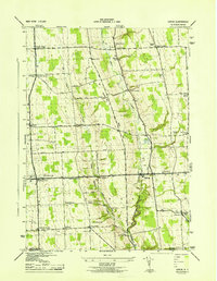
1943 Map of Genoa
USGS Topo · Published 1943About this map
Big Salmon Creek and its companion, Little Salmon Creek, carve deep valleys through this agricultural landscape in southern Cayuga County during the early 1940s. The settlement pattern is defined by frequent road intersections known as "corners," including Wheeler Corners, Stewart Corners, and Bruton Corners. These clusters often served as local hubs for rural life, supported by a network of numbered district schools such as School No 10 and School No 5.
Find a feature on this map
51 named features on this map. Tap any name to fly to it.
Don’t see what you’re looking for? This feature index may not catch every label — zoom into the map to look around manually.
Map Details
Editions of this 1943 Genoa Map
This is the sole edition of this map. No revisions or reprints were ever made.
Other maps of this area

1898 · Moravia
USGS Topo · 1:62,500

1899 · Auburn
USGS Topo · 1:62,500

1899 · Skaneateles
USGS Topo · 1:62,500

1902 · Skaneateles
USGS Topo · 1:62,500

1902 · Moravia
USGS Topo · 1:62,500

1902 · Genoa
USGS Topo · 1:62,500

1902 · Auburn
USGS Topo · 1:62,500

1942 · Ludlowville
USGS Topo · 1:24,000

1942 · Sheldrake
USGS Topo · 1:24,000

1942 · Genoa
USGS Topo · 1:24,000