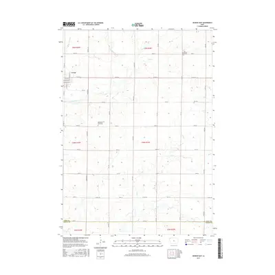
2015 Map of George East
USGS Topo · Published 2015About this map
George sits at the western edge of this agricultural landscape in Lyon County, where the town grid transitions into a vast network of section roads. The terrain is defined by the drainage of the Little Rock River and its numerous tributaries, including Whitney Cr, Rat Cr, and Otter Cr. This survey illustrates the persistent importance of local religious and burial sites in the rural Midwest, with the Zoar Presbyterian Church and its associated Zoar Presbyterian Church Cem positioned near the headwaters of Zoar Cr. Further south, the Lyon County First Presbyterian Church and its Lyon County First Presbyterian Church Cem stand as landmarks along the section lines, while the Zion Cem remains a notable point of reference in the eastern portion of the quadrangle. The map captures the interface of established township boundaries and modern county highways like Co HWY a34.
Find a feature on this map
44 named features on this map. Tap any name to fly to it.
Don’t see what you’re looking for? This feature index may not catch every label — zoom into the map to look around manually.
Map Details
Editions of this 2015 George East Map
This is the sole edition of this map. No revisions or reprints were ever made.
Other maps of this area

1954 · Fairmont
USGS Topo · 1:250,000

1955 · Sioux Falls
USGS Topo · 1:250,000

1958 · Sioux Falls
USGS Topo · 1:250,000

1958 · Fairmont
USGS Topo · 1:250,000

1964 · Matlock
USGS Topo · 1:24,000

1964 · Sheldon
USGS Topo · 1:24,000

1964 · Boyden
USGS Topo · 1:24,000

1971 · Edna
USGS Topo · 1:24,000

1971 · George West
USGS Topo · 1:24,000

1972 · Ashton
USGS Topo · 1:24,000