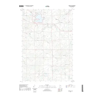
2018 Map of George Lake
USGS Topo · Published 2018About this map
George Lake and its surrounding wetlands dominate this Oneida County landscape, where the Pelican River and the North Branch Pelican River converge. The settlement of Malvern stands at a crossroads of fire lanes and forest roads, serving as a gateway to a dense network of water bodies including Midget Lake, Long Lake, and Alligator Lake. This 2018 survey reveals a terrain defined by its complex hydrology, with numerous small creeks such as Noisy Cr and Haymeadow Cr draining the marshy lowland. The road network, featuring routes like Co Hwy G and Malvern Fire Ln, reflects a mix of local travel and access to timber or recreation areas. Notable for its glacial features, the map shows a landscape of kettle lakes and meandering streams, providing a detailed look at the northern woods before reaching the more developed corridors of the county.
Find a feature on this map
53 named features on this map. Tap any name to fly to it.
Don’t see what you’re looking for? This feature index may not catch every label — zoom into the map to look around manually.
Map Details
Editions of this 2018 George Lake Map
This is the sole edition of this map. No revisions or reprints were ever made.
Other maps of this area

1940 · Parrish
USGS Topo · 1:48,000

1940 · Monico
USGS Topo · 1:48,000

1940 · Rhinelander
USGS Topo · 1:48,000

1942 · Elcho
USGS Topo · 1:48,000

1949 · Rhinelander
USGS Topo · 1:48,000

1950 · Monico
USGS Topo · 1:48,000

1950 · Elcho
USGS Topo · 1:48,000

1950 · Parrish
USGS Topo · 1:48,000

1952 · Parrish
USGS Topo · 1:48,000

1954 · Iron Mountain
USGS Topo · 1:250,000