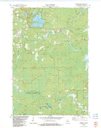
1982 Map of George Lake
USGS Topo · Published 1983About this map
Glacial waters and dense woodlands define this portion of Oneida County, where the Pelican River carves a winding path toward the south. The landscape is dominated by a complex network of kettle lakes, including the expansive George Lake and smaller bodies like Clear Lake, Midget Lake, and Perch Lake. These water features, joined by George Cr and Haymeadow Creek, represent the classic Northwoods topography utilized by local recreational and timber interests.
Find a feature on this map
28 named features on this map. Tap any name to fly to it.
Don’t see what you’re looking for? This feature index may not catch every label — zoom into the map to look around manually.
Map Details
Editions of this 1982 George Lake Map
This is the sole edition of this map. No revisions or reprints were ever made.
Other maps of this area

1940 · Parrish
USGS Topo · 1:48,000

1940 · Monico
USGS Topo · 1:48,000

1940 · Rhinelander
USGS Topo · 1:48,000

1942 · Elcho
USGS Topo · 1:48,000

1949 · Rhinelander
USGS Topo · 1:48,000

1950 · Monico
USGS Topo · 1:48,000

1950 · Elcho
USGS Topo · 1:48,000

1950 · Parrish
USGS Topo · 1:48,000

1952 · Parrish
USGS Topo · 1:48,000

1954 · Iron Mountain
USGS Topo · 1:250,000