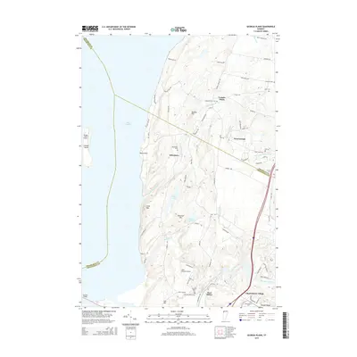
2015 Map of Georgia Plains
USGS Topo · Published 2015About this map
The Lamoille River valley and the eastern shores of Lake Champlain define this corner of northwestern Vermont. Local history and genealogy are well-represented by a cluster of named cemeteries, including Goodrich Cem, Sabin Cem, and the dual New West Milton Cem and Old West Milton Cem sites. The landscape is punctuated by prominent rises such as Eagle Mtn and Diamond Hill, which overlook smaller water bodies like Long Pond and Round Pond. The settlement pattern reflects the area's rural character, with established villages like Georgia Plains, Miltonboro, and Checkerberry Village serving as local hubs. In the western portion, Savage Island sits offshore, while the Sand Bar Bridge provides a vital corridor across the lake waters.
Find a feature on this map
78 named features on this map. Tap any name to fly to it.
Don’t see what you’re looking for? This feature index may not catch every label — zoom into the map to look around manually.
Map Details
Editions of this 2015 Georgia Plains Map
This is the sole edition of this map. No revisions or reprints were ever made.
Other maps of this area

1894 · Plattsburg
USGS Topo · 1:62,500

1895 · Rouse Point
USGS Topo · 1:62,500

1906 · Plattsburg
USGS Topo · 1:62,500

1907 · Rouse Point
USGS Topo · 1:62,500

1913 · Milton
USGS Topo · 1:48,000

1914 · St. Albans
USGS Topo · 1:48,000

1915 · Milton
USGS Topo · 1:62,500

1916 · St. Albans
USGS Topo · 1:62,500

1939 · Rouses Point
USGS Topo · 1:62,500

1939 · Plattsburg
USGS Topo · 1:62,500