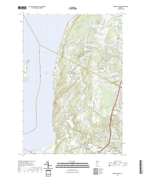
2024 Map of Georgia Plains
USGS Topo · Published 2024About this map
Lake Champlain defines the western edge of this landscape, where the shoreline is marked by Savage Island and Beans Point. The interior reveals a established network of small communities and crossroads such as Georgia Plains and Checkerberry Village, connected by a web of local routes including Georgia Shore Rd and Plains Rd. The terrain is characterized by prominent rises like Eagle Mtn and Bradley Hill, while the Lamoille River and Stone Bridge Brook drain the countryside toward the lake. Multiple historical burial sites, including Sabin Cem and Crown Cem, are preserved near the border of Franklin and Chittenden counties. The presence of small airfields like Savage Island Airport and Shaw Meadow Airport alongside these older settlements suggests a blend of traditional agricultural patterns and modern aviation utility in this Vermont coastal region.
Find a feature on this map
79 named features on this map. Tap any name to fly to it.
Don’t see what you’re looking for? This feature index may not catch every label — zoom into the map to look around manually.
Map Details
Editions of this 2024 Georgia Plains Map
This is the sole edition of this map. No revisions or reprints were ever made.
Other maps of this area

1894 · Plattsburg
USGS Topo · 1:62,500

1895 · Rouse Point
USGS Topo · 1:62,500

1906 · Plattsburg
USGS Topo · 1:62,500

1907 · Rouse Point
USGS Topo · 1:62,500

1913 · Milton
USGS Topo · 1:48,000

1914 · St. Albans
USGS Topo · 1:48,000

1915 · Milton
USGS Topo · 1:62,500

1916 · St. Albans
USGS Topo · 1:62,500

1939 · Rouses Point
USGS Topo · 1:62,500

1939 · Plattsburg
USGS Topo · 1:62,500