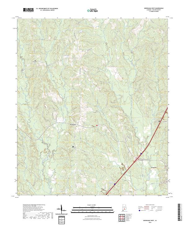
2024 Map of Georgiana West
USGS Topo · Published 2024About this map
Georgiana and the smaller settlement of Starlington anchor this portion of Butler County, where the landscape is defined by a dense network of winding watercourses and rural corridors. The terrain is drained by several prominent streams, including Long Creek, Panther Creek, and Oaklog Creek, which meander through the southern Alabama timberlands and agricultural plots. For those tracing family histories in the region, the map provides precise locations for Mount Pisgah Cem, Stamps Cem, and Ebenezer Cem, many of which are situated near long-established routes like Mt Pisgah Rd and Ebenezer Rd. This modern survey illustrates the persistent rural character of the area, showing how contemporary infrastructure like Roger & Herman Blvd overlays a landscape still largely organized around its original water sources and family-named landmarks such as Casey Pond and Wise Pond.
Find a feature on this map
39 named features on this map. Tap any name to fly to it.
Don’t see what you’re looking for? This feature index may not catch every label — zoom into the map to look around manually.
Map Details
Editions of this 2024 Georgiana West Map
This is the sole edition of this map. No revisions or reprints were ever made.
Other maps of this area

1953 · Andalusia
USGS Topo · 1:250,000

1957 · Andalusia
USGS Topo · 1:250,000

1971 · Lyeffion
USGS Topo · 1:24,000

1971 · Greenville West
USGS Topo · 1:24,000

1971 · Mc Kenzie
USGS Topo · 1:24,000

1971 · Georgiana East
USGS Topo · 1:24,000

1971 · Garland
USGS Topo · 1:24,000

1971 · Bethel
USGS Topo · 1:24,000

1971 · Georgiana West
USGS Topo · 1:24,000

1981 · Forest Home
USGS Topo · 1:24,000