
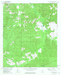
1971 Map of Georgiana West
USGS Topo · Published 1991About this map
Georgiana and the surrounding Butler County countryside are captured here during a period of steady growth and agricultural stability. The landscape is defined by a dense network of watercourses, including Panther Creek and Oaklog Creek, which carve through the terrain and influence the placement of early homesteads and transport routes. Evidence of established rural communities is seen in the clustering of local landmarks such as Mt Pisgah Ch and Providence, indicating a well-distributed population connected by light-duty roads and field lines.
Find a feature on this map
17 named features on this map. Tap any name to fly to it.
Don’t see what you’re looking for? This feature index may not catch every label — zoom into the map to look around manually.
Map Details
Editions of this 1971 Georgiana West Map
This is the sole edition of this map. No revisions or reprints were ever made.
Other maps of this area

1953 · Andalusia
USGS Topo · 1:250,000

1957 · Andalusia
USGS Topo · 1:250,000

1971 · Lyeffion
USGS Topo · 1:24,000

1971 · Greenville West
USGS Topo · 1:24,000

1971 · Mc Kenzie
USGS Topo · 1:24,000

1971 · Georgiana East
USGS Topo · 1:24,000

1971 · Garland
USGS Topo · 1:24,000

1971 · Bethel
USGS Topo · 1:24,000

1981 · Forest Home
USGS Topo · 1:24,000
1981 · Pine Apple South
USGS Topo · 1:24,000