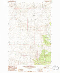
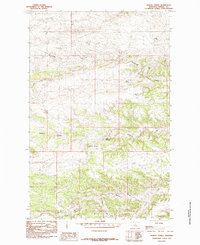
1985 Map of Gerhard Corner
USGS Topo · Published 1985About this map
Gerhard Corner stands as a focal point in this Fergus County landscape, situated at the intersection of local rangelands and a complex system of seasonal watercourses. The terrain is defined by dramatic elevation changes, notably anchored by the prominence of Bald Butte in the northern reach. This mid-1980s data records the hydrological layout of the region, where the North Fork and South Fork converge amidst a network of coulees. The map traces the winding paths of Cutbank Creek and Rose Creek, providing a detailed look at the drainage patterns essential for ranching and land management in this part of Montana. Named features like Sourdough Spring and Sawmill Coulee offer localized clues for researchers tracking historic land use or family holdings within the township and range boundaries of T 21 N and T 20 N.
Find a feature on this map
11 named features on this map. Tap any name to fly to it.
Don’t see what you’re looking for? This feature index may not catch every label — zoom into the map to look around manually.
Map Details
Editions of this 1985 Gerhard Corner Map
This is the sole edition of this map. No revisions or reprints were ever made.
Other maps of this area

1954 · Taffy Ridge
USGS Topo · 1:24,000

1954 · Lewistown
USGS Topo · 1:250,000

1959 · Lewistown
USGS Topo · 1:250,000

1978 · Lewistown
USGS Topo · 1:100,000

1985 · The Horse Ranch
USGS Topo · 1:24,000

1985 · Woodhawk Hill
USGS Topo · 1:24,000
1985 · Christina
USGS Topo · 1:24,000
1985 · Winifred East
USGS Topo · 1:24,000
1985 · Reppe Butte
USGS Topo · 1:24,000
1985 · Bakers Spring
USGS Topo · 1:24,000