
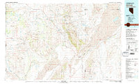
1981 Map of Gerlach
USGS Topo · Published 1981About this map
Gerlach and the company town of Empire anchor this study of the Great Basin in the early 1980s, where the high desert terrain of the Granite Range meets the expansive white flats of the Black Rock Desert. This map captures a landscape defined by extreme geography and isolated rail stops along the Western Pacific line, including Trego, Cholona, and Reynard. To the east, the Black Rock Range and the Calico Mountains overlook the sinks of the Quinn River, while the western portion of the sheet is dominated by the Smoke Creek basin and the volcanic features of The Lava Beds. Resource extraction is evident at the Arcturus Mine and Cassidy Mine, reflecting the region's long-standing connection to mining. The presence of Duck Flat and several seasonal water bodies like Smoke Creek Reservoir illustrate the precarious water management required in this arid environment at the edge of the California and Nevada border.
Find a feature on this map
66 named features on this map. Tap any name to fly to it.
Don’t see what you’re looking for? This feature index may not catch every label — zoom into the map to look around manually.
Map Details
Editions of this 1981 Gerlach Map
2 editions found
Other maps of this area

1886 · Alturas
USGS Topo · 1:250,000

1886 · Honey Lake
USGS Topo · 1:250,000

1886 · Disaster
USGS Topo · 1:250,000

1886 · Granite Range
USGS Topo · 1:250,000

1889 · Long Valley
USGS Topo · 1:250,000

1891 · Honey Lake
USGS Topo · 1:250,000

1892 · Alturas
USGS Topo · 1:250,000

1893 · Honey Lake
USGS Topo · 1:250,000

1893 · Disaster
USGS Topo · 1:250,000

1894 · Granite Range
USGS Topo · 1:250,000