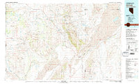
1981 Map of Gerlach
USGS Topo · Published 1981About this map
Gerlach stands as the primary hub of this high-desert region, situated at the southwestern edge of the massive Black Rock Desert. In the early 1980s, this landscape was defined by the industrial presence of Empire and the logistical infrastructure of the Western Pacific railroad, which skirts the eastern margins of the Granite Range. The map reveals a complex system of water management and natural drainage, from the Smoke Creek basin and Smoke Creek Res to the intricate network of springs such as White Heifer Springs and Poodle Spring that dot the arid basins.
Find a feature on this map
109 named features on this map. Tap any name to fly to it.
Don’t see what you’re looking for? This feature index may not catch every label — zoom into the map to look around manually.
Map Details
Editions of this 1981 Gerlach Map
2 editions found

Other maps of this area

1886 · Alturas
USGS Topo · 1:250,000

1886 · Honey Lake
USGS Topo · 1:250,000

1886 · Disaster
USGS Topo · 1:250,000

1886 · Granite Range
USGS Topo · 1:250,000

1889 · Long Valley
USGS Topo · 1:250,000

1891 · Honey Lake
USGS Topo · 1:250,000

1892 · Alturas
USGS Topo · 1:250,000

1893 · Honey Lake
USGS Topo · 1:250,000

1893 · Disaster
USGS Topo · 1:250,000

1894 · Granite Range
USGS Topo · 1:250,000