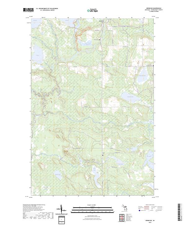
2023 Map of Germfask
USGS Topo · Published 2023About this map
Germfask sits at the junction of the Manistique River and several key transport routes in Schoolcraft County. This recent survey illustrates a landscape dominated by complex waterways and managed wetlands, including the Lower Goose Pen Pool and A Pool. The local road and trail system reflects a mixture of utility and recreation, featuring names like N Powerline Rd alongside the Otter Run Ski Trl and Skunk Ridge Ski Trl. Genealogists will find three distinct burial sites: Germfask Cem, the Old Germfask Cem, and Blaney Cem further south. The southern portion of the quadrangle transitions into the dense Bear Creek Swamp and the waters of Mezik Lake, showcasing the interconnected drainage of the Driggs River and Mezik-Creek before they reach the main river channel.
Find a feature on this map
96 named features on this map. Tap any name to fly to it.
Don’t see what you’re looking for? This feature index may not catch every label — zoom into the map to look around manually.
Map Details
Editions of this 2023 Germfask Map
This is the sole edition of this map. No revisions or reprints were ever made.
Other maps of this area

1931 · Seney SW
USGS Topo · 1:31,680

1931 · Manistique River NE
USGS Topo · 1:31,680

1931 · Manistique River SE
USGS Topo · 1:31,680

1931 · Blaney SW
USGS Topo · 1:31,680

1931 · Seney SE
USGS Topo · 1:31,680

1931 · Blaney NE
USGS Topo · 1:31,680

1931 · Blaney SE
USGS Topo · 1:31,680

1931 · Blaney NW
USGS Topo · 1:31,680

1931 · Driggs Lake SE
USGS Topo · 1:31,680

1954 · Sault Sainte Marie
USGS Topo · 1:250,000