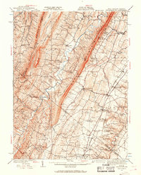
1937 Map of Gerrardstown
USGS Topo · Published 1968About this map
Gerrardstown and the eastern slopes of North Mountain define this landscape, where the Shenandoah Valley’s agricultural patterns meet the ridges of the Appalachians. The 1930s settlement pattern is densely marked by community institutions such as Pitzers Chapel, Sylvan Retreat School, and the Hopewell Meeting House. Along the eastern edge, the Pennsylvania railroad corridor facilitates the growth of towns like Inwood and Bunker Hill, while the historic Old Pike runs parallel through Darkesville.
Find a feature on this map
125 named features on this map. Tap any name to fly to it.
Don’t see what you’re looking for? This feature index may not catch every label — zoom into the map to look around manually.
Map Details
Editions of this 1937 Gerrardstown Map
3 editions found

Other maps of this area

1884 · Harpers Ferry
USGS Topo · 1:125,000

1891 · Harpers Ferry
USGS Topo · 1:125,000

1893 · Harpers Ferry
USGS Topo · 1:125,000

1894 · Winchester
USGS Topo · 1:125,000

1898 · Paw Paw
USGS Topo · 1:62,500

1899 · Hancock
USGS Topo · 1:62,500

1900 · Pawpaw
USGS Topo · 1:62,500

1901 · Hancock
USGS Topo · 1:62,500

1910 · Paw Paw
USGS Topo · 1:62,500

1912 · Williamsport
USGS Topo · 1:62,500