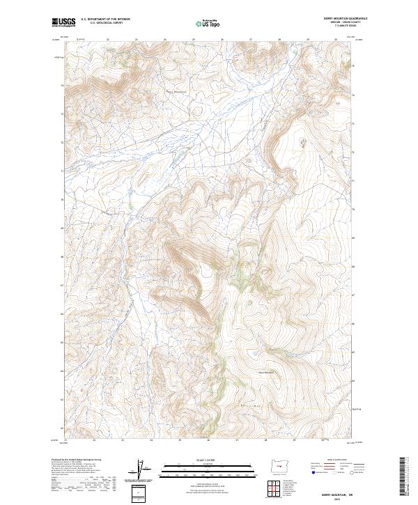
2023 Map of Gerry Mountain
USGS Topo · Published 2023About this map
Maury Mountains dominate the northern landscape of this Crook County quadrangle, where the high-altitude terrain is defined by a network of drainage systems. The topography is shaped by prominent peaks such as Gerry Mtn and Moon Mountain, providing a clear look at the headwaters of several critical seasonal waterways. Water moves through the landscape via Camp Creek and its West Fork, while the southern reaches are drained by Glover Creek and Sand Hollow Creek. These natural features dictate the path of the limited road infrastructure, specifically Camp Creek Rd and SE GI Rd, which follow the contours of the land. The absence of concentrated settlements highlights the area's use for ranching and resource management, with the Yank Gulch formation illustrating the dramatic vertical relief typical of this part of the Oregon high country.
Find a feature on this map
14 named features on this map. Tap any name to fly to it.
Don’t see what you’re looking for? This feature index may not catch every label — zoom into the map to look around manually.
Map Details
Editions of this 2023 Gerry Mountain Map
This is the sole edition of this map. No revisions or reprints were ever made.
Other maps of this area

1951 · Post
USGS Topo · 1:62,500

1955 · Crescent
USGS Topo · 1:250,000

1955 · Bend
USGS Topo · 1:250,000

1957 · Crescent
USGS Topo · 1:250,000

1957 · Bend
USGS Topo · 1:250,000

1958 · Crescent
USGS Topo · 1:250,000

1958 · Bend
USGS Topo · 1:250,000

1970 · Crescent
USGS Topo · 1:250,000

1981 · Prineville
USGS Topo · 1:100,000

1982 · Arrowwood Point
USGS Topo · 1:24,000