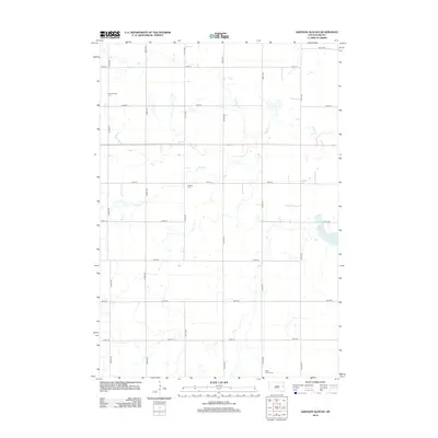
2012 Map of Gertson Slough
USGS Topo · Published 2012About this map
Scandinavian Cem and Garfield Cem stand as quiet landmarks within this rural expanse of Hamlin County. The landscape is defined by its precise section-line grid, where gravel and paved roads like 444th Ave and 194th St segment the prairie into large agricultural blocks. This 2012 survey illustrates a classic South Dakota township structure where small family cemeteries and seasonal waterways provide the primary interruptions to the geometric farm parcels. The drainage of Dolph Cr wanders across the northern half of the quadrangle, eventually feeding toward the namesake Gertson Slough in the east. Further south, Saint Peters Cem sits near the intersection of 446th Ave, anchoring the southern edge of this farming community.
Find a feature on this map
19 named features on this map. Tap any name to fly to it.
Don’t see what you’re looking for? This feature index may not catch every label — zoom into the map to look around manually.
Map Details
Editions of this 2012 Gertson Slough Map
This is the sole edition of this map. No revisions or reprints were ever made.
Other maps of this area

1953 · Watertown
USGS Topo · 1:250,000

1958 · Watertown
USGS Topo · 1:250,000

1968 · Lake Preston NE
USGS Topo · 1:24,000

1968 · Erwin
USGS Topo · 1:24,000

1968 · Badger
USGS Topo · 1:24,000

1969 · Hayti
USGS Topo · 1:24,000

1969 · Lake Norden
USGS Topo · 1:24,000

1973 · Bryant NE
USGS Topo · 1:24,000

1973 · Bryant
USGS Topo · 1:24,000
1973 · Gertson Slough
USGS Topo · 1:24,000