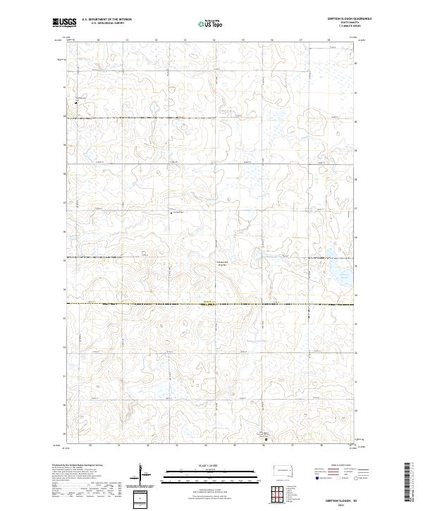
2021 Map of Gertson Slough
USGS Topo · Published 2021About this map
The Coteau des Prairies plateau forms the primary landscape of this section of the Glacial Lake Plains, where the terrain is marked by the eponymous Gertson Slough and the headwaters of Dolph Cr. Spanning the border of Hamlin and Kingsbury counties, the area is characterized by a sparse grid of section roads like 445th Ave and 196th St that navigate the varied wetland depressions. The settlement pattern is deeply tied to the region's ethnic heritage, evidenced by the location of the Saint Peter's German Lutheran Church Cem and the Scandinavian Cem. These sites, along with Garfield Cem, provide significant touchpoints for genealogical research in this quiet agricultural landscape during the early 21st century.
Find a feature on this map
27 named features on this map. Tap any name to fly to it.
Don’t see what you’re looking for? This feature index may not catch every label — zoom into the map to look around manually.
Map Details
Editions of this 2021 Gertson Slough Map
This is the sole edition of this map. No revisions or reprints were ever made.
Other maps of this area

1953 · Watertown
USGS Topo · 1:250,000

1958 · Watertown
USGS Topo · 1:250,000

1968 · Lake Preston NE
USGS Topo · 1:24,000

1968 · Erwin
USGS Topo · 1:24,000

1968 · Badger
USGS Topo · 1:24,000

1969 · Hayti
USGS Topo · 1:24,000

1969 · Lake Norden
USGS Topo · 1:24,000

1973 · Bryant NE
USGS Topo · 1:24,000

1973 · Bryant
USGS Topo · 1:24,000
1973 · Gertson Slough
USGS Topo · 1:24,000