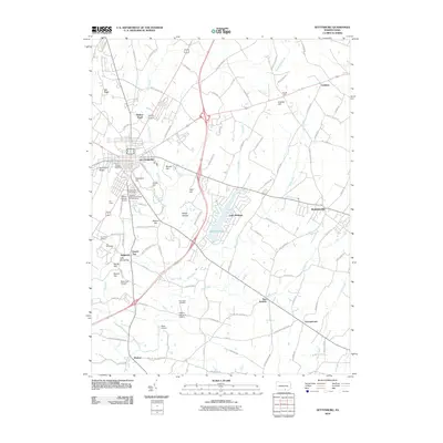
2010 Map of Gettysburg
USGS Topo · Published 2010About this map
Gettysburg serves as the focal point of this Adams County landscape, where the town's grid meets the surrounding ridge-and-valley terrain. Significant commemorative landmarks dominate the southern topography, including Seminary Ridge, Cemetery Hill, and Little Round Top. These features, alongside The Peach Orchard and The Wheatfield, outline the geography of the Civil War battlefield. Beyond the town center, the map documents the growth of residential and agricultural areas near Lake Heritage and smaller outlying settlements like Two Taverns, Bonneauville, and Barlow. Local aviation is represented by several small landing strips, such as Warner Hospital Airport and Rena-Vera Airport. Waterways like Rock Creek and White Run drain the rolling countryside, while numerous family-named roads and cemeteries, including Evergreen Cemetery and Pine Bank Cemetery, provide critical data for local history and genealogical research.
Find a feature on this map
101 named features on this map. Tap any name to fly to it.
Don’t see what you’re looking for? This feature index may not catch every label — zoom into the map to look around manually.
Map Details
Editions of this 2010 Gettysburg Map
This is the sole edition of this map. No revisions or reprints were ever made.
Other maps of this area

1908 · Gettysburg
USGS Topo · 1:62,500

1909 · Fairfield
USGS Topo · 1:62,500

1911 · Taneytown
USGS Topo · 1:62,500

1911 · Emmitsburg
USGS Topo · 1:62,500

1942 · Gettysburg
USGS Topo · 1:125,000

1943 · Emmitsburg
USGS Topo · 1:62,500

1944 · Gettysburg
USGS Topo · 1:31,680

1944 · Mc Sherrystown
USGS Topo · 1:31,680

1944 · Littlestown
USGS Topo · 1:31,680

1944 · Arendtsville
USGS Topo · 1:31,680
Featured Places
- Gettysburg, PA
- Bonneauville, PA
- Mount Joy Township, PA
- Germany Township, PA
- Sedgwick, Cumberland Township