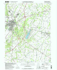
1994 Map of Gettysburg
USGS Topo · Published 1998About this map
The Gettysburg National Military Park dominates this landscape, preserving the complex topography of the 1863 battlefield. Notable tactical landmarks such as Little Round Top, Cemetery Hill, and the labyrinthine boulders of Devils Den are meticulously detailed, alongside the State Memorial and various observation towers. Surrounding the park, the borough of Gettysburg serves as a hub for both education and local government, housing Gettysburg College, the Courthouse, and schools like the James Gettys Sch.
Find a feature on this map
68 named features on this map. Tap any name to fly to it.
Don’t see what you’re looking for? This feature index may not catch every label — zoom into the map to look around manually.
Map Details
Editions of this 1994 Gettysburg Map
This is the sole edition of this map. No revisions or reprints were ever made.
Other maps of this area

1908 · Gettysburg
USGS Topo · 1:62,500

1909 · Fairfield
USGS Topo · 1:62,500

1911 · Taneytown
USGS Topo · 1:62,500

1911 · Emmitsburg
USGS Topo · 1:62,500

1942 · Gettysburg
USGS Topo · 1:125,000

1943 · Emmitsburg
USGS Topo · 1:62,500

1944 · Gettysburg
USGS Topo · 1:31,680

1944 · Mc Sherrystown
USGS Topo · 1:31,680

1944 · Littlestown
USGS Topo · 1:31,680

1944 · Arendtsville
USGS Topo · 1:31,680