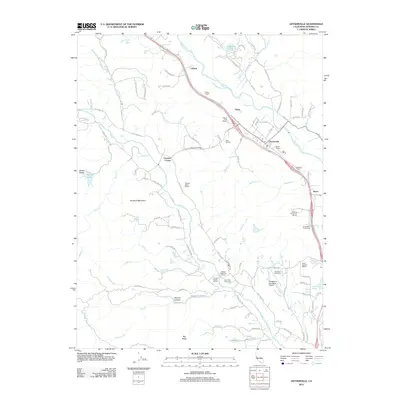
2012 Map of Geyserville
USGS Topo · Published 2012About this map
Vineyards and wineries dominate this portion of the northern Sonoma County landscape along the Russian River. The town of Geyserville serves as a central hub, surrounded by a dense concentration of viticultural landmarks such as Geyser Peak Winery, Nervo Winery, and Pastori Winery. To the west, the terrain rises toward Bradford Mountain, where the drainage of Dry Creek and its many tributaries, including Peña Creek and Grape Creek, shape the agricultural valleys. The map illustrates a mature wine-growing region where historic family names persist on the land, evident at Long Ranch Family Cemetery and Olive Hill Cemetery. Transportation routes like Chianti Road and the proximity of the Healdsburg Municipal Airport to the south facilitate the movement of people and goods through these valleys, while small settlements like Chianti and Nervo anchor the rural crossroads.
Find a feature on this map
99 named features on this map. Tap any name to fly to it.
Don’t see what you’re looking for? This feature index may not catch every label — zoom into the map to look around manually.
Map Details
Editions of this 2012 Geyserville Map
This is the sole edition of this map. No revisions or reprints were ever made.
Other maps of this area

1920 · Healdsburg
USGS Topo · 1:62,500

1921 · Skaggs
USGS Topo · 1:62,500

1921 · Kelseyville
USGS Topo · 1:62,500

1933 · Healdsburg
USGS Topo · 1:48,000

1938 · Hopland
USGS Topo · 1:62,500

1940 · Healdsburg
USGS Topo · 1:62,500

1943 · Cazadero
USGS Topo · 1:24,000

1943 · Skaggs Springs
USGS Topo · 1:24,000

1943 · Kelseyville
USGS Topo · 1:62,500

1943 · Hopland
USGS Topo · 1:62,500