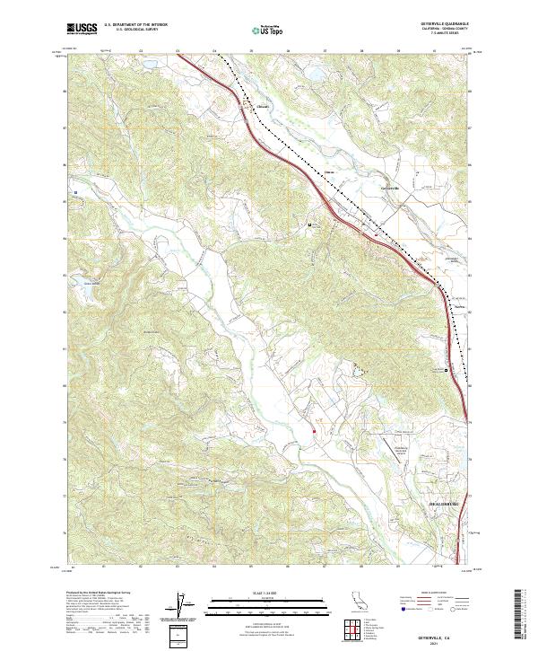
2021 Map of Geyserville
USGS Topo · Published 2021About this map
The Russian River and Dry Creek dominate this landscape in Sonoma County, carving through a region defined by its viticultural heritage and scattered small settlements. Geyserville sits at the heart of the quadrangle, flanked by the smaller communities of Chianti, Omus, and Nervo. The terrain rises from the river valley toward the prominent heights of Bradford Mtn and Big Ridge, with numerous drainages like Peña Cr and Grape Cr feeding the primary watercourses.
Find a feature on this map
116 named features on this map. Tap any name to fly to it.
Don’t see what you’re looking for? This feature index may not catch every label — zoom into the map to look around manually.
Map Details
Editions of this 2021 Geyserville Map
This is the sole edition of this map. No revisions or reprints were ever made.
Other maps of this area

1920 · Healdsburg
USGS Topo · 1:62,500

1921 · Skaggs
USGS Topo · 1:62,500

1921 · Kelseyville
USGS Topo · 1:62,500

1933 · Healdsburg
USGS Topo · 1:48,000

1938 · Hopland
USGS Topo · 1:62,500

1940 · Healdsburg
USGS Topo · 1:62,500

1943 · Cazadero
USGS Topo · 1:24,000

1943 · Skaggs Springs
USGS Topo · 1:24,000

1943 · Kelseyville
USGS Topo · 1:62,500

1943 · Hopland
USGS Topo · 1:62,500